R80 Motorized Total Station

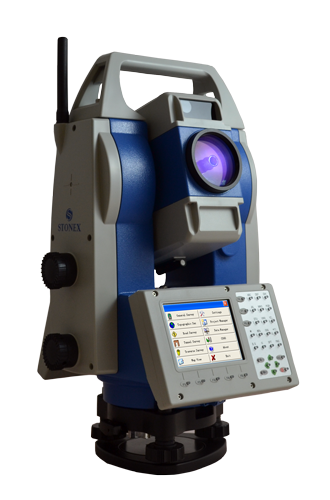
Motorized Total Station for high-precision works

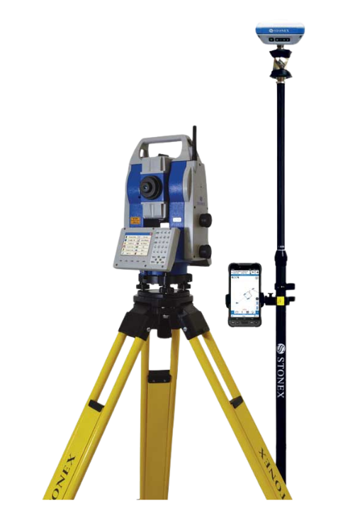
Stonex R80 is a Motorized Total Station for classic jobs for survey and stakeout and perfect for high precision surveying areas, such as rail traffic monitoring, control of structures, bridges, dams and landslide areas.

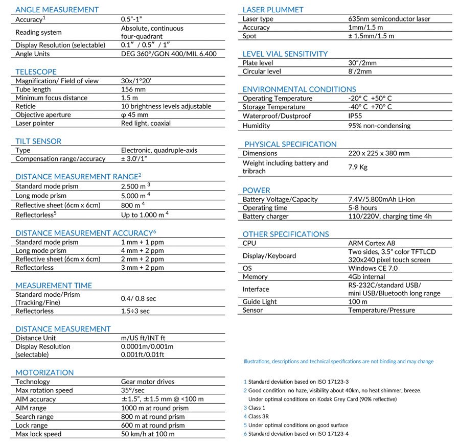
R80 adopts up to date automatic prism recognition and positioning technology and has a high accuracy of 0.5″-1″.
R80 has a distance measurement accuracy of 1 mm + 1 ppm (Prism) and a 1.000 m long range reflectorless distance measurement.

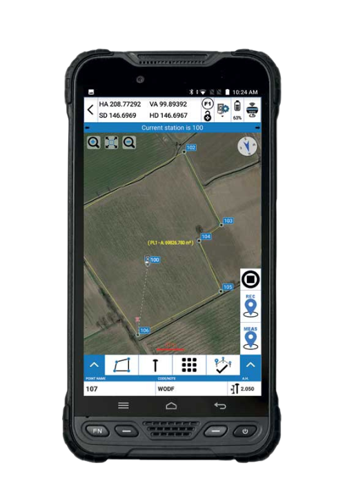
This motorized Total Station run Windows CE 7.0 operating system and each user can choose the software that best suits own needs. It supports also SDK and external control protocol for software developing.

HIGH PRECISION SURVEYING

Angle measurement accuracy 0.5″-1″.
Distance measurement accuracy 1 mm + 1 ppm (Prism)

LONG DISTANCE REFLECTORLESS

By using digital phase laser ranging technology, R80 guarantees high accuracy long range measurements: up to 1.000 m in reflectorless mode and up to 5.000 m using a single prism, with millimeter accuracy.

BLUETOOTH LONG RANGE

Use R80 built-in Bluetooth for data transfer or to control the TS remotely.

OnePole Solution

TS+GPS with Cube-a Software

OnePole Solution combines the millimeter positioning accuracy of a prism measurement with the advantage of measuring points not visible from the TS through the GPS Receiver. A total station needs local control points on which it can be set. These points must be visible from the station and therefore the line of sight has to be free of obstacles. An RTK GPS receiver can determine its position in seconds with centimeter level accuracy using data from satellites. The ability to combine and use both systems simultaneously greatly improves surveying efficiency.

Advantages of the system:

  • The OnePole Solution allows you to work simultaneously with TS and GPS
  • TS and GPS (and diastimeter) can be simultaneously connected to the controller using Bluetooth
  • Change the measurement mode from TS to GPS by one simple tap on the always accessible switch button
  • Reduce prism search times through auto aiming to the current GPS position
  • Easily setup your TS position by Station On Point and Free Station/Resection programs
  • View on Google Maps your TS and GPS surveys

Cube-h24 Solution

Cube-h24 has been designed by Stonex to perform operations to check movements of points in natural places or artificial structures, considered to be at risk of stability. In general, the materialization of the points is made with prisms used for topography, in order to determine the real distances from a station point. It is however possible to use points marked on a reflecting surface.

Cube-h24 allows to:

  • Set up surveys and calculation procedures, in order to compare the coordinates of the points subject to control in subsequent interventions
  • Check either in real time or in scheduled time the displacements of the points

Main features

  • Cube-h24 is a vertical solution for monitoring with motorized TS
  • TS communication management
  • Project management
  • Continuous or periodic acquisition
  • Graphical reports of the results
  • Alerts and alarms generated in a range of critical values defined by user
  • Aending log files and alerts or alarms to office by FTP or email

Data sheet

Videos

Get Quote
Send Enquiry