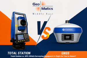
If you’re planning a survey job anywhere in Oman, whether it’s a road alignment in Muscat, a plot boundary in Barka, or a pipeline corridor out toward Duqm, you’ll eventually hit the same question every site engineer and land surveyor asks at some point: “Should I use a Total Station or a GPS/GNSS receiver for this?”
It’s not a trick question, and there isn’t one universal answer. Both instruments are core to modern land surveying in Oman, but they’re built for different jobs, different terrains, and different levels of accuracy. Pick the wrong one for the task and you either waste hours in the field or end up with data that doesn’t hold up. 😅
In this guide, we’ll break down how a Total Station and a GPS/GNSS Receiver actually differ, where each one shines across Oman’s construction, oil and gas, and telecom sectors, and how to decide which one (or both) your project actually needs.
📐 What Is a Total Station?
A Total Station is an optical surveying instrument that combines an electronic theodolite (for measuring horizontal and vertical angles) with an EDM (Electronic Distance Measurement) unit. Set it up on a known point, sight your target with the telescope, and it calculates precise angles and distances, then works out coordinates and elevations automatically.
It’s the instrument you’ll see set up on a tripod at almost every construction site in Muscat, whether it’s building layout, road setting-out, or as-built surveys. Brands like Stonex, which we supply here at Geomatics Middle East, are widely trusted across Oman’s surveying and construction sector for their reliability and accuracy in the field.
🛰️ What Is a GPS/GNSS Receiver?
A GNSS (Global Navigation Satellite System) receiver, often just called “GPS” on site even though it also uses GLONASS, Galileo, and BeiDou constellations, determines position by receiving signals from satellites orbiting the earth. In RTK (Real-Time Kinematic) mode, a base station and rover work together to deliver centimeter-level accuracy in real time, without needing a clear line of sight between points.
This is the equipment you reach for when you need to cover large, open areas quickly, like topographic surveys, boundary surveys across big plots of land, or utility corridor mapping across long stretches of desert or open terrain outside the city.
⚖️ Total Station vs. GPS: The Key Differences
- Line of sight: Total Stations need a clear line of sight between the instrument and the target. GNSS receivers don’t; they just need a clear view of the sky.
- Accuracy: Total Stations typically offer higher precision at short to medium range (sub-millimeter to a few millimeters), which matters for building layout and structural work. RTK GPS delivers centimeter-level accuracy, which is more than enough for most large-scale mapping and boundary work.
- Speed over large areas: A GNSS rover can move quickly from point to point across an open site without repositioning an instrument. A Total Station needs repeated setups (traversing) to cover the same ground, which takes longer.
- Urban and covered environments: Total Stations work reliably indoors, under structures, in tunnels, and in dense urban areas where tall buildings can block satellite signal. GNSS accuracy can degrade near high-rises, under bridges, or in areas with heavy signal multipath.
- Setup and workflow: Total Stations require a known control point and backsight to start work. GNSS RTK setups can establish position independently once linked to a base station or a correction network.
- Weather and environment: GNSS performance can be affected by dense tree cover, but generally handles Oman’s open, arid terrain very well. Total Stations are largely unaffected by satellite conditions but do need clear optical sightlines, which can be a challenge on dusty sites.
🏗️ Which One Fits Your Project in Oman?
Choose a Total Station when:
- You’re doing building layout, structural setting-out, or precise alignment work on a construction site in Muscat or elsewhere
- You need high-accuracy elevation data for road or drainage design
- You’re surveying indoors, under cover, or in areas with poor satellite visibility, common around Muscat’s older, denser neighborhoods like Ruwi and Muttrah
- Your project requires sub-centimeter precision, such as monitoring surveys or as-built verification
Choose GPS/GNSS (RTK) when:
- You’re surveying large open plots, industrial land, or desert terrain around Sohar, Duqm, or Salalah
- You need to cover a lot of ground quickly for topographic or boundary surveys
- You’re mapping utility corridors, pipelines, or telecom routes that stretch over long distances
- Speed matters more than millimeter-level precision for the task at hand
Use both when:
Most experienced survey teams in Oman don’t pick one over the other, they combine both. A common workflow is establishing control points across a site using GNSS RTK for speed, then switching to a Total Station for the detailed, high-precision layout and structural work. This hybrid approach is especially common on larger construction and infrastructure projects across the Sultanate.
🇴🇲 Why This Choice Matters More in Oman Specifically?
- Mixed terrain: Oman’s landscape ranges from dense urban Muscat to open desert and mountainous wadi regions, meaning survey teams regularly switch between instruments depending on location.
- Large-scale infrastructure projects: With ongoing developments in Duqm, Sohar Port, and various PDO and OQ project sites, GNSS is often the faster choice for initial site-wide mapping before detailed Total Station work begins.
- Urban density in Muscat: Areas like Al Khuwair, Qurum, and the Muscat Expressway corridor often have signal interference from tall structures, making Total Stations more reliable for precision layout work in these zones.
- Extreme heat and dust: Both instrument types need to be rugged enough for Oman’s climate. Equipment durability and IP-rated protection matter as much as accuracy specs when choosing gear for year-round fieldwork here.
💰 Total Station vs. GPS: Cost Considerations in Oman
Pricing for both Total Stations and GNSS/RTK systems in Oman varies depending on brand, accuracy class, and included accessories (data collectors, software, prisms, base-rover kits). As a general rule, entry to mid-range Total Stations and single-base RTK GNSS setups are comparably priced, while high-precision or multi-frequency GNSS systems can cost more upfront but save significant time on large-area projects. If you’d like a quote tailored to your project scope, our team at Geomatics Middle East can walk you through the right setup and pricing based on your site requirements.
🤝 Why Buy From Geomatics Middle East?
At Geomatics Middle East (GME), we supply and support both Stonex Total Stations and Stonex GNSS/GPS receivers for surveying and construction teams across Oman. Whether you need a single instrument or a combined Total Station + GNSS setup for your project, our team can help you choose the right equipment, provide calibration and after-sales servicing, and offer rental options if you need equipment short-term.
Browse our Total Station range or our GNSS/GPS receivers, or get in touch with us to discuss what’s right for your next project in Muscat or anywhere across Oman.
🙋 Frequently Asked Questions
Is GPS surveying accurate enough for construction layout in Oman?
RTK GPS typically delivers 1–2 cm accuracy, which works well for topographic and boundary surveys. For precise structural layout and building setting-out, a Total Station is generally the better choice due to its higher precision.
Can I use GNSS/GPS in dense areas of Muscat?
Yes, but accuracy can be affected by signal blockage from tall buildings or dense urban structures. In these situations, a Total Station is often more reliable for precise work.
Do I need both a Total Station and a GNSS receiver?
Many survey teams in Oman use both. GNSS is used for quick, wide-area control and mapping, while the Total Station handles detailed, high-accuracy layout and structural surveys.
Which brand does Geomatics Middle East supply for Total Stations and GNSS in Oman?
We supply Stonex Total Stations and Stonex GNSS/GPS receivers, along with calibration, servicing, and rental support across Oman.
What is the typical accuracy difference between a Total Station and RTK GPS?
Total Stations can achieve sub-centimeter to millimeter accuracy at shorter ranges, while RTK GPS typically achieves 1–2 cm accuracy over much larger areas in real time.
🚧 Final Thoughts
There’s no single “better” instrument between a Total Station and a GPS/GNSS receiver, it genuinely comes down to your project, your terrain, and your accuracy requirements. For precise construction layout and indoor or dense urban work across Muscat, a Total Station is hard to beat. For fast, large-area coverage across Oman’s open terrain, GNSS RTK is the clear winner. And for most serious survey teams, having access to both is what makes a project run smoothly from start to finish.
If you’re not sure which setup fits your next project, our team at Geomatics Middle East is happy to walk you through it. Reach out to us and we’ll help you pick the right tool for the job.