Total stations are advanced surveying instruments used for measuring horizontal and vertical angles, as well as distances with high precision. Combining the functionalities of a theodolite and an electronic distance measuring device, total stations have become indispensable tools in the fields of civil engineering, construction, archaeology, and more.
Importance and Applications in Various Fields
Total stations play a crucial role in various fields due to their accuracy, efficiency, and versatility. In civil engineering, they are used for land surveying, site layout, and construction stakeout. Architects rely on total stations for precise measurements during building design and construction. Archaeologists utilize them for site mapping and documentation, aiding in the preservation of cultural heritage. Additionally, total stations find applications in forestry, environmental monitoring, and mining, among others.
Brief History and Evolution of Total Stations
Total stations emerged in the mid-20th century, combining electronic distance measuring with theodolites. Bulky and manual at first, they’ve evolved into compact, sophisticated instruments with automatic features and GPS integration.
Components of a Total Station
Electronic Distance Measurement (EDM)
Total stations rely on Electronic Distance Measurement (EDM) for pinpoint accuracy. Using light waves (infrared or laser), EDM blasts a signal to a target, measures its travel time back, and calculates the distance. This forms the core of a total station’s power, allowing for highly precise measurements over long distances – invaluable for tasks like mapping and boundary definition.
Theodolite
Theodolites, with their rotating telescope, are a key part of total stations. They precisely measure horizontal and vertical angles. Combining these capabilities with EDM (Electronic Distance Measurement) allows total stations to capture comprehensive spatial data for surveying and construction tasks.
Microprocessor
The microprocessor acts as the total station’s brain, handling various functions and data processing. Modern ones enable real-time calculations, on-site adjustments, and external device integration (like GPS). User-friendly interfaces and customizable settings further enhance usability and efficiency.
Data Recording and Storage
Total stations require effective data capture and storage. They come equipped with internal memory or SD cards for storing vast amounts of survey data. Modern instruments often boast advanced software, facilitating data organization, analysis, and export for engineers.
Display Unit
The total station’s display unit acts as a real-time control center. Equipped with a high-resolution screen, it offers clear menus, measurement results, and various functions. Advanced models may even boast touchscreens and customizable layouts for a user-friendly experience.
Battery and Power Management
Battery life is a key concern for total station users, especially during long surveys. They rely on rechargeable batteries with varying capacities based on model and brand. To extend operation time, total stations often have power-saving features like auto-off or adjustable screen brightness. Proper battery management, including regular charging, is vital for uninterrupted surveying.
Working Principles of Total Station
Measurement of Angles and Distances
Total stations combine EDM (electronic distance measurement) and theodolites for precise measurements. EDM fires an infrared beam at a target, calculates distance based on reflection time, and leverages the speed of light. Theodolites provide high-accuracy angles. This duo empowers tasks like mapping and boundary definition.
Triangulation and Trigonometry
Triangulation forms the basis of total station measurements, where the instrument establishes a triangle between itself, the target, and a known point. By measuring the angles and distances of this triangle, trigonometric principles are applied to compute the precise coordinates of the target point. This method ensures accurate positioning even over large distances, making total stations indispensable tools in surveying and construction.
Calibration and Accuracy Considerations
Total station accuracy relies on regular calibration. This ensures precise measurements by compensating for temperature, humidity, and instrument wear. Calibration involves checks and adjustments to maintain the instrument’s internal alignment and distance measurement. Understanding error sources and applying corrections further refines accuracy, making total stations vital for reliable surveying.
Integration with GPS and Other Technologies
Modern total stations elevate surveying with GPS integration. This powerful combo delivers pinpoint accuracy even in tricky areas by combining GPS data with traditional measurements. Additionally, features like electronic data recording and real-time transfer streamline workflows, boosting efficiency on the job site.
Best Total Station for Use in Oman
Criteria for selecting the best total station for use in Oman:
- Accuracy and precision: Given the diverse terrain and demanding surveying requirements in Oman, the total station must offer high accuracy and precision in measurements.
- Robustness and durability: Oman’s harsh environmental conditions, including extreme temperatures and rugged landscapes, necessitate a total station that can withstand such challenges and maintain reliable performance.
- Adaptability to local conditions: The selected total station should be capable of functioning effectively in Oman’s unique environmental and climatic conditions.
- Ease of use and user interface: User-friendly features and intuitive interfaces are crucial for operators working in the field, ensuring smooth and efficient surveying operations.
- Integration capabilities: The total station should seamlessly integrate with other surveying equipment and software commonly used in Oman, enhancing workflow efficiency and data management.
- Support and service: Availability of technical support, training resources, and maintenance services locally is essential to ensure uninterrupted operation and timely assistance when needed.
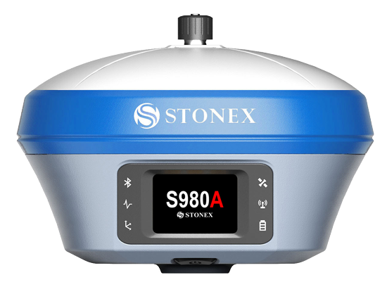
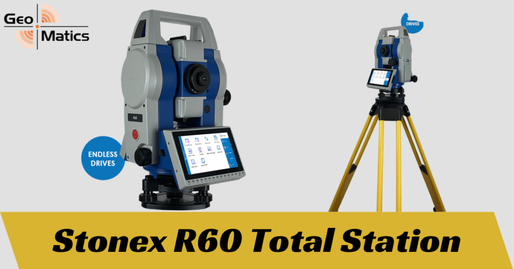
Introduction to the R60 Android Total Station:
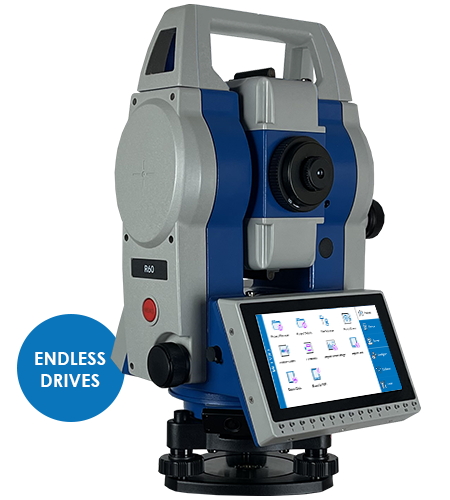
The R60 Android Total Station stands as a groundbreaking solution tailored to meet the rigorous demands of surveying in Oman. Equipped with a 5.5-inch touchscreen and the Android operating system, it offers users a familiar and intuitive interface akin to smartphones, enhancing ease of use and productivity in the field.
Features and specifications of the R60 Android Total Station:
- Android OS: The R60 Total Station integrates the Android operating system, empowering operators with a wide range of features and functions for enhanced efficiency.
- Cube-a software: This software provides a new horizontal view and seamless integration with GNSS surveys, offering unparalleled versatility and customization options.
- Wireless connectivity: With Bluetooth capabilities, the R60 enables wireless data exchange between the total station and remote controllers, eliminating the hassle of cables and enhancing convenience in the field.
- Accuracy and range: The R60 Total Station delivers impressive accuracy, with options available for both 2″ and 1″ accuracy levels. It boasts a reflectorless measurement range of up to 1000 meters, ensuring precise data capture even in challenging terrain.
- Durability: Built to withstand harsh environmental conditions, the R60 is designed for durability and reliability, making it well-suited for the rugged landscapes of Oman.
- Prism accuracy: With a prism, the R60 achieves remarkable accuracy, ensuring precise measurements with minimal margin for error.
Case studies or testimonials highlighting the effectiveness of the R60 Android Total Station in Oman:
- Testimonial from Galfar Engineering & Contracting Firm: “The R60 Android Total Station has been instrumental in our surveying projects across Oman. Its intuitive interface and seamless integration with GNSS surveys have significantly enhanced our efficiency in the field. The durability and accuracy of the R60 make it our go-to choice for demanding terrain conditions.”
- Case study: Land Surveying Project in Oman’s Mountainous Region: The R60 Android Total Station proved its mettle in a challenging land surveying project conducted in Oman’s mountainous region. Despite rugged terrain and adverse weather conditions, the R60 delivered accurate measurements consistently, allowing the survey team to complete the project ahead of schedule. Its wireless connectivity and user-friendly interface streamlined data collection and processing, earning praise from both field operators and project managers.
Applications of Total Stations
Land Surveying and Mapping
Total stations revolutionize the way land surveying and mapping tasks are conducted. With their precise angle and distance measurements, they enable surveyors to accurately determine the boundaries of land parcels, create topographic maps, and generate contour lines. This technology is indispensable in urban planning, infrastructure development, and cadastral mapping projects. By integrating GPS systems, total stations enhance the efficiency and accuracy of surveying tasks even in challenging terrains.
Construction and Engineering Projects
In construction and engineering projects, total stations play a crucial role in site layout, monitoring structural deformations, and ensuring precise placement of elements such as foundations, columns, and beams. They aid in maintaining alignment, levels, and dimensions according to design specifications, contributing to the overall quality and safety of the project.
Archaeology and Cultural Heritage Preservation
Total stations are valuable tools in archaeology for documenting and mapping excavation sites, recording the precise locations of artifacts and features within the landscape. They help archaeologists preserve cultural heritage by facilitating accurate documentation of historical sites, enabling researchers to analyze spatial relationships and create detailed 3D models for further study and conservation efforts.
Forestry and Environmental Monitoring
In forestry and environmental monitoring, total stations are utilized for conducting topographic surveys, assessing terrain characteristics, and monitoring changes in landscapes over time. They assist in forest inventory, habitat mapping, and ecosystem monitoring by providing accurate data on tree heights, canopy coverage, and ground contours, essential for sustainable forest management and environmental conservation.
Mining and Resource Exploration
Total stations play a vital role in mining and resource exploration by providing precise measurements for geological mapping, identifying mineral deposits, and planning extraction operations. They assist in delineating ore bodies, calculating volumes of excavated materials, and monitoring slope stability, contributing to efficient resource utilization and safety in mining operations.
Advantages and Limitations of Total Stations
Advantages:
- High accuracy and precision: Total stations offer precise measurements, crucial for engineering projects where accuracy is paramount.
- Versatility and adaptability: They can be used in various terrains and conditions, making them versatile tools for different applications.
- Time efficiency: Total stations streamline surveying processes, saving time and resources compared to traditional methods.
- Integration with other technologies: They can be seamlessly integrated with GPS, CAD software, and other technologies, enhancing efficiency and data accuracy.