Introduction:
Imagine peering into the Earth’s subsurface without the need for excavation. Ground Penetrating Radar (GPR) technology makes this possible, offering invaluable insights for diverse applications in engineering, archaeology, geology, and beyond. This blog post delves into the science and applications of GPR surveys, providing a comprehensive understanding for civil engineers and professionals seeking advanced subsurface investigation methods.
GPR Fundamentals:
- Operating Principle: GPR utilizes high-frequency electromagnetic waves transmitted into the ground. These waves interact with buried objects and interfaces, reflecting back to the surface antenna.
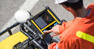
- Data Acquisition and Processing: Reflected signals are analyzed and processed, generating cross-sectional images or radargrams depicting the subsurface features.
- Penetration Depth: Penetration depth varies depending on soil conditions, target materials, and GPR frequency. Typically, depths range from a few meters to tens of meters.
GPR Applications in Civil Engineering:
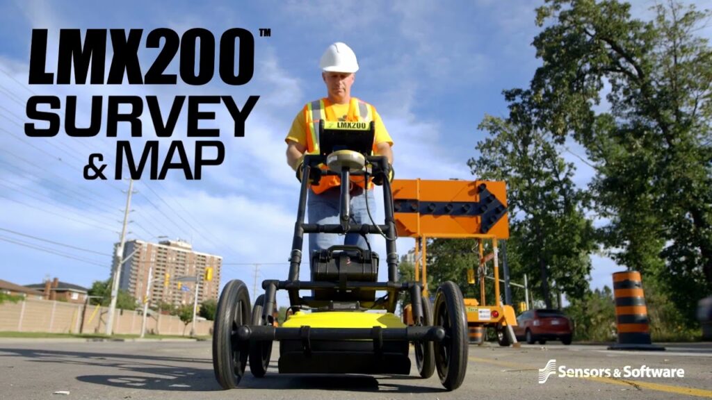
- Utility Mapping: Locating and mapping underground utilities like pipes, cables, and conduits to avoid damage during construction.
- Structural Assessments: Evaluating the integrity of concrete structures, detecting reinforcing steel, and identifying hidden voids or anomalies.
- Foundation Investigations: Understanding soil composition, identifying bedrock depth, and assessing potential geotechnical hazards.
- Environmental Site Assessments: Locating buried drums, tanks, and other potential contaminants.
- Roadway Investigations: Evaluating pavement thickness, identifying subsurface voids, and locating buried infrastructure.
Advantages of GPR:
- Non-destructive: GPR avoids excavation, minimizing environmental impact and site disruption.
- Rapid Data Acquisition: Surveys can be completed quickly and efficiently, offering immediate insights.
- Cost-effective: Compared to traditional excavation methods, GPR can be a more cost-efficient solution.
- Versatility: Applicable to diverse subsurface materials, including soil, concrete, and ice.
Limitations of GPR:
- Penetration Depth: Penetration depth is limited by soil conductivity and target material properties.
- Data Interpretation: Skilled professionals are required to accurately interpret complex radargrams.
- Environmental Factors: Moisture content and soil composition can affect signal propagation and data quality.
Conclusion:
GPR technology offers a valuable tool for civil engineers, providing non-destructive insights into the subsurface for informed decision-making. Understanding its principles, applications, and limitations enables engineers to leverage this technology effectively for diverse subsurface investigations.
Please feel free to contact me if you have any further questions.